

The
Mini Library
(or
libMini for short) is a real-time terrain rendering system which is
licensed
under the terms of the LGPL. It is based on my '98 paper and
supports asynchronous paging, dynamic
terrain, multiple geospatial tile sets and much more. It
compiles on Irix, Linux, MacOS X and Windows (VC++ and cygwin). The
library is included in the Virtual Terrain Project of Ben
Discoe and an early version is utilized in the DX 8 game AquaNox.
Get libMini from the download page.
Please
visit the libMini User
Gallery to see some user-contributed screen shots.
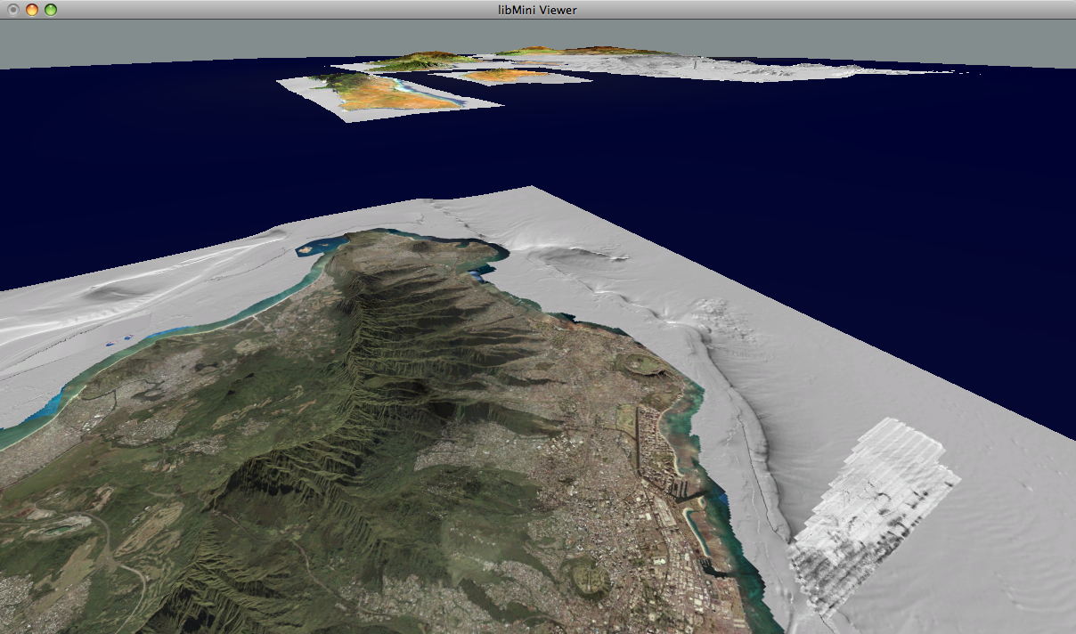
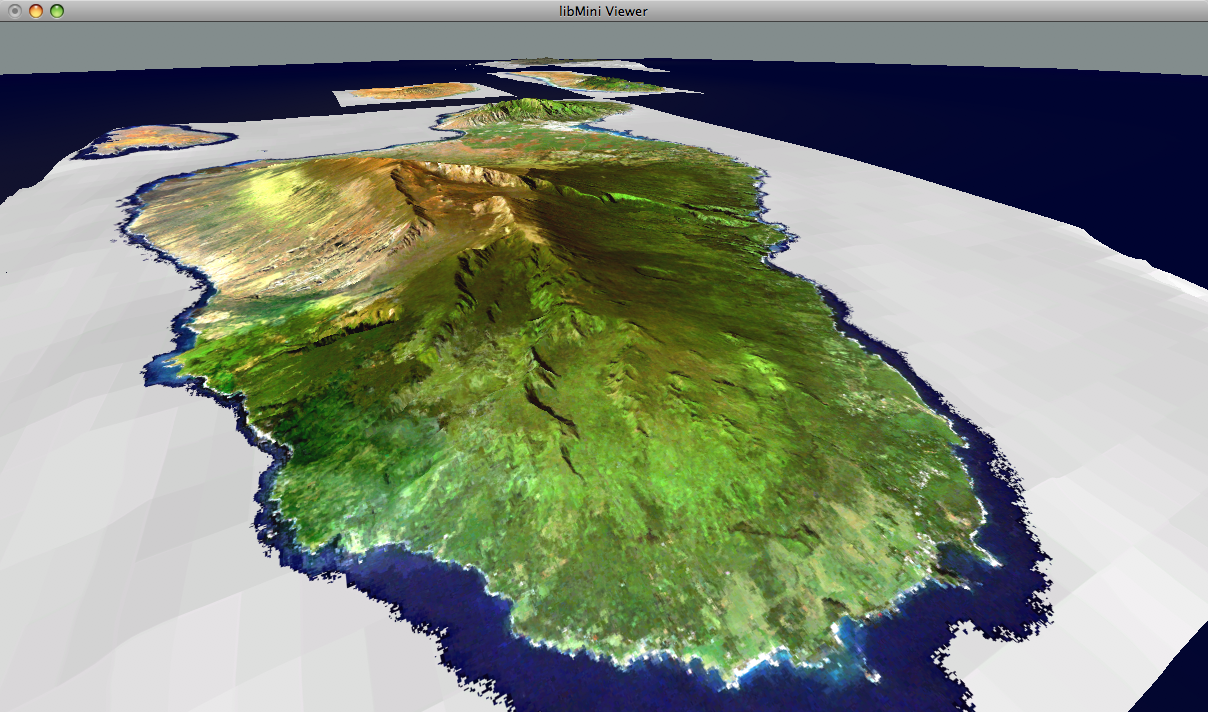
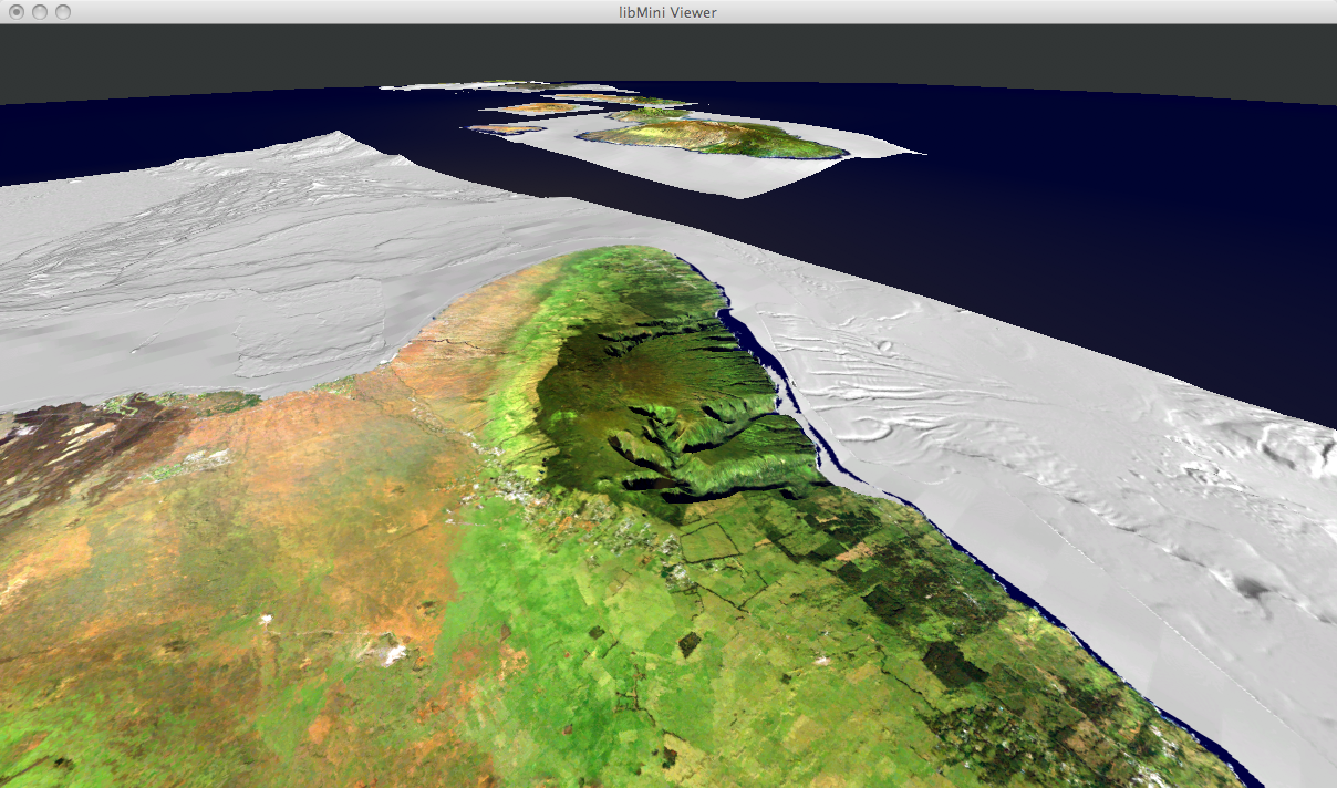
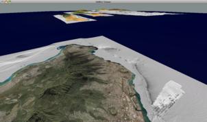
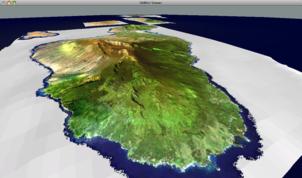
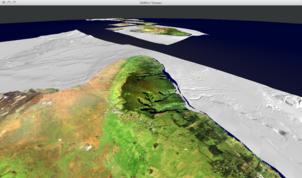
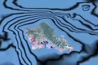
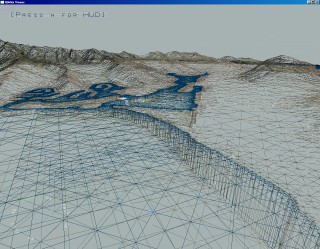
libMini QTViewer:
The libMini QTViewer is able to view multiple tilesets produced with VTBuilder
on a night and day representation of the entire earth. It features an
intuitive exploration of the tileset through the QT user
interface. Below are some screen shots
of multiple tilesets covering the Hawai'ian islands.
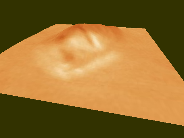
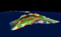
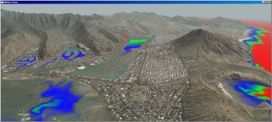
libGrid Library:
The libGrid library provides a resampling core similar to VTBuilder. With libGrid
you can easily produce displayable tilesets from your geo-spatial data
and imagery. The main difference to VTBuilder is that libGrid is able
to produce the tilesets entirely automatic without manual
interaction through a world map user interface. It also features a
clean and generic interface to a geospatial resampling core, which is
regression-tested to be accurate to the point. Below is a screen shot of the example data provided with libGrid:

libMini
Demos:
Currently,
four libMini demos are available: the Yukon
Demo, the Stuttgart Demo,
the Hawaii Demo and the Fränkische Demo.
In order to compile the demos under Irix, Linux, MacOS X or Windows,
download the Mini Library
and the demos to the same directory, unpack the archives and follow the
instructions in the README. Each demo can be run in stereoFX mode by
supplying -s on the command line. Add -a for anaglyph stereoFX. Below
are some screen shots of the demos.
 Stereo
image of Hawai'i using anaglyph rendering (red / cyan)
Stereo
image of Hawai'i using anaglyph rendering (red / cyan)
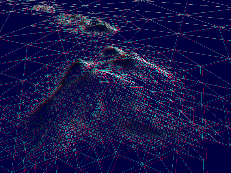
 Stereo
image of Hawai'i using wire frame mode
Stereo
image of Hawai'i using wire frame mode
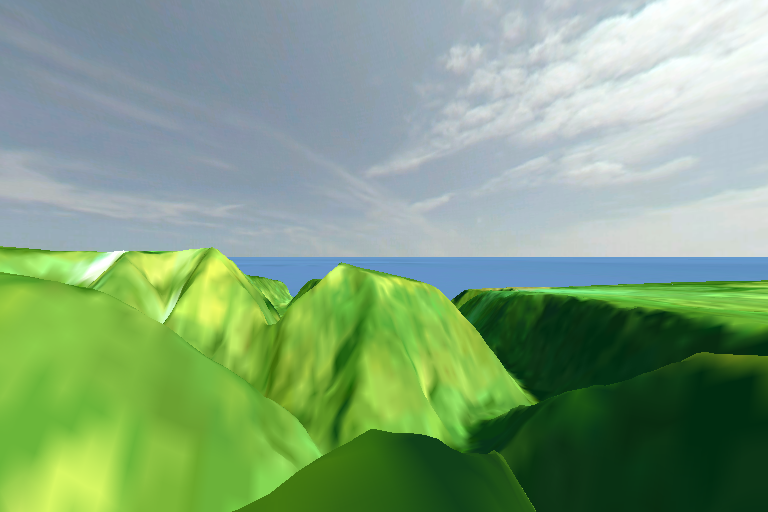
Yukon
Demo:
The
Yukon Demo
illustrates the basic use of the Mini Library.
It additionally shows
volumetric ground fog and a sky layer.
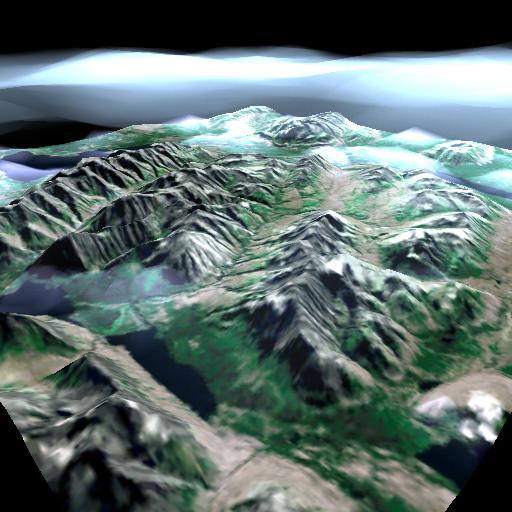 Kluane
National Park in Yukon Territory, Canada
Kluane
National Park in Yukon Territory, Canada
Stuttgart
Demo:
The
Stuttgart Demo
visualizes hi-res LIDAR data of the city center of
Stuttgart.
The dataset is courtesy of ifp.
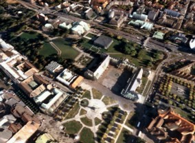 The
New Castle of Stuttgart, Germany
The
New Castle of Stuttgart, Germany
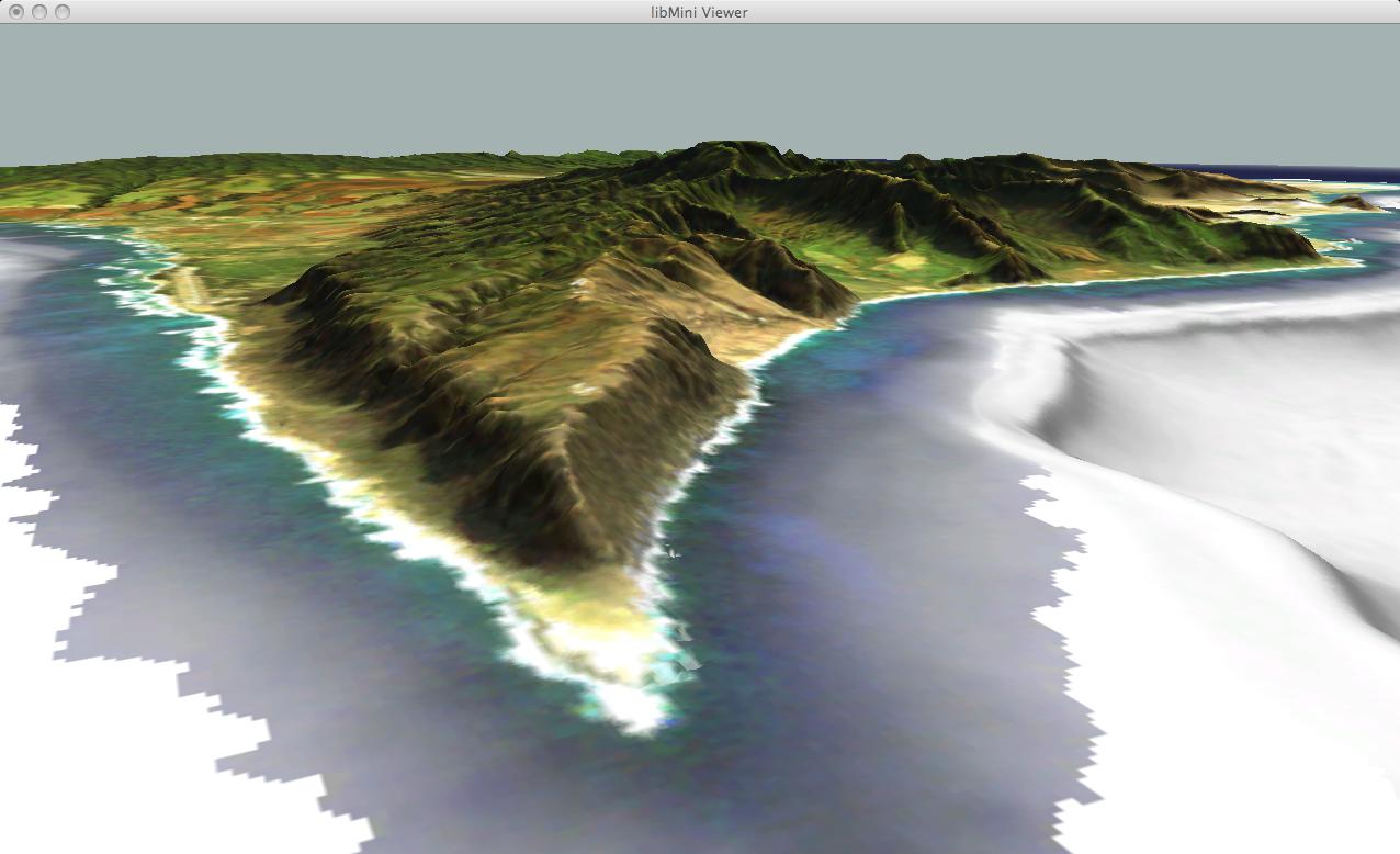
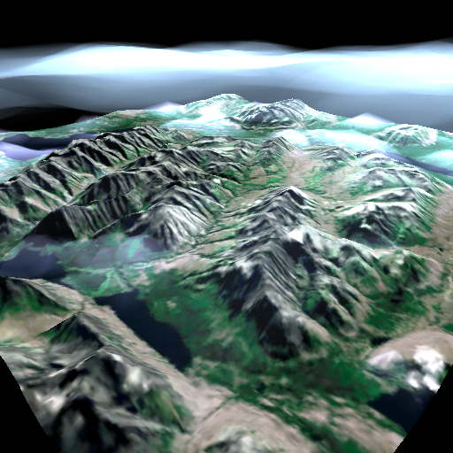
Hawaii
Demo:
The
Hawaii Demo is an
example of handling high-res geo-referenced terrain data from multiple
sources. For
best performance a GeForceFX with at least 64 MB is recommended. On an
Athlon 2.2 GHz GeForce FX 5800 Linux system the performance is about 20
million geomorphed vertices per second. At a
target frame rate of 50 Hz, this
translates to a system
load of roughly 10-20%.
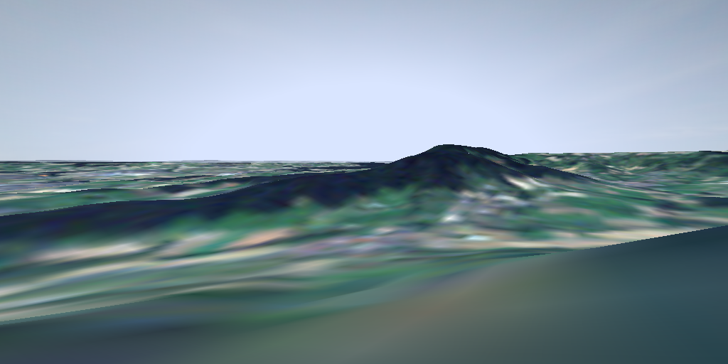
The
terrain data includes all main islands of Hawai'i in an area of 750x540
square kilometers. The original data has a resolution of up to 10
meters. In order to keep download size reasonable (ca. 42 MB
compressed),
the data has been down-sampled to approximately 100 meters for the DEM
and 50 meters for the orthophotos.
 The
back end of Waipi'o
Valley on the Big Island of Hawai'i
The
back end of Waipi'o
Valley on the Big Island of Hawai'i
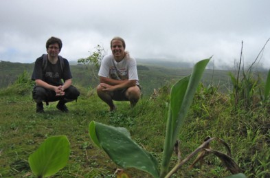 Ben
and me on the "illegal" trail at the back end of Waipi'o
Valley
Ben
and me on the "illegal" trail at the back end of Waipi'o
Valley
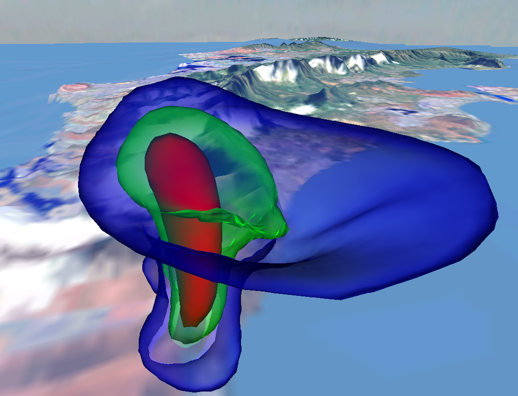
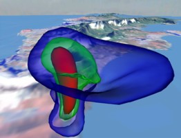 Visualization
of a thunderstorm over Waimanalo, Oahu
Visualization
of a thunderstorm over Waimanalo, Oahu
 Contour
lines draped over the bathymetry using the libMini
pixel shader plugin
Contour
lines draped over the bathymetry using the libMini
pixel shader plugin
 Per-pixel
shading using the libMini pixel shader plugin
Per-pixel
shading using the libMini pixel shader plugin
The
demo includes freely available terrain data from the following sources:
DEM:
USGS Geographic Data Download
http://edc.usgs.gov/geodata/
SDTS DEM:
MapMart Global Mapping Solutions
http://www.mapmart.com/DEM/DEM.htm
LandSat ETM orthophotos and bathymetric data of Hawaii:
The Hawaii Project of the NOAA Coastal Services Center
http://www.csc.noaa.gov/crs/lca/hawaii.html
LandSat TM and ETM+ orthophotos world-wide:
Global Land Cover Facility
http://glcf.umiacs.umd.edu
Sky Dome:
Philo's Sky Collection
http://www.philohome.com/skycollec/skycollec.htm
Oahu
Demo:
The
Oahu
Demo uses the libMini async tile cache to page the 70 GB of original
Oahu
data in real-time. The entire island is covered with less than 0.5m for
the aerials and 5-10m for the terrain. Due to
the immense size of the data, the demo is only available as a tileset tarball (5GB).
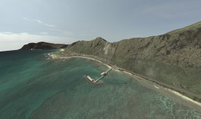 Hires
visualization of Makai Pier, Oahu, Hawai'i
Hires
visualization of Makai Pier, Oahu, Hawai'i
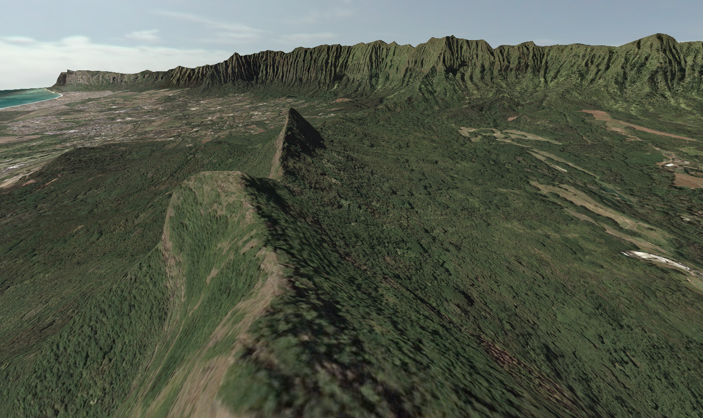
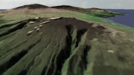
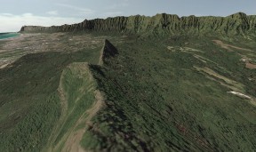 East Ko'olau
Range overlooked from Olomana Peak, remnant of an eroded
volcanic caldera on Oahu
East Ko'olau
Range overlooked from Olomana Peak, remnant of an eroded
volcanic caldera on Oahu
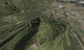 First part of
Haiku Stairs aka Stairway to Heaven (see www.friendsofhaikustairs.org)
First part of
Haiku Stairs aka Stairway to Heaven (see www.friendsofhaikustairs.org)
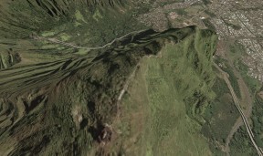 Up in
Heaven (for a detailed hike description see www.backyardoahu.com)
Up in
Heaven (for a detailed hike description see www.backyardoahu.com)
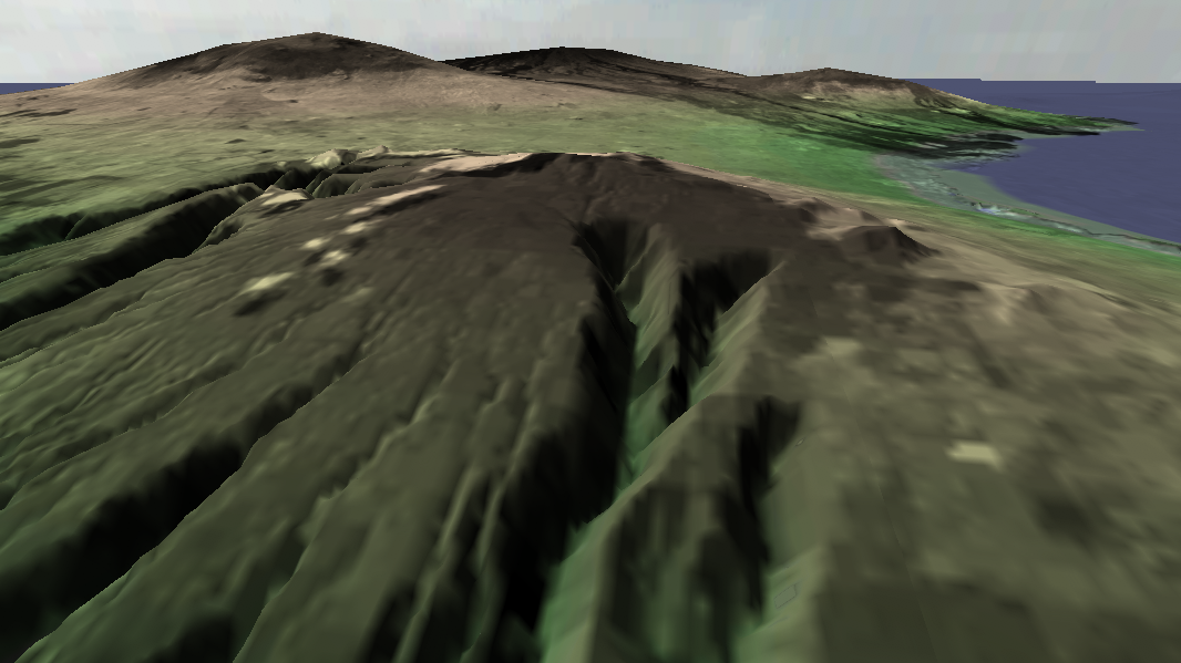
 Hawaii
Kai with on-the-fly sea level extraction
Hawaii
Kai with on-the-fly sea level extraction
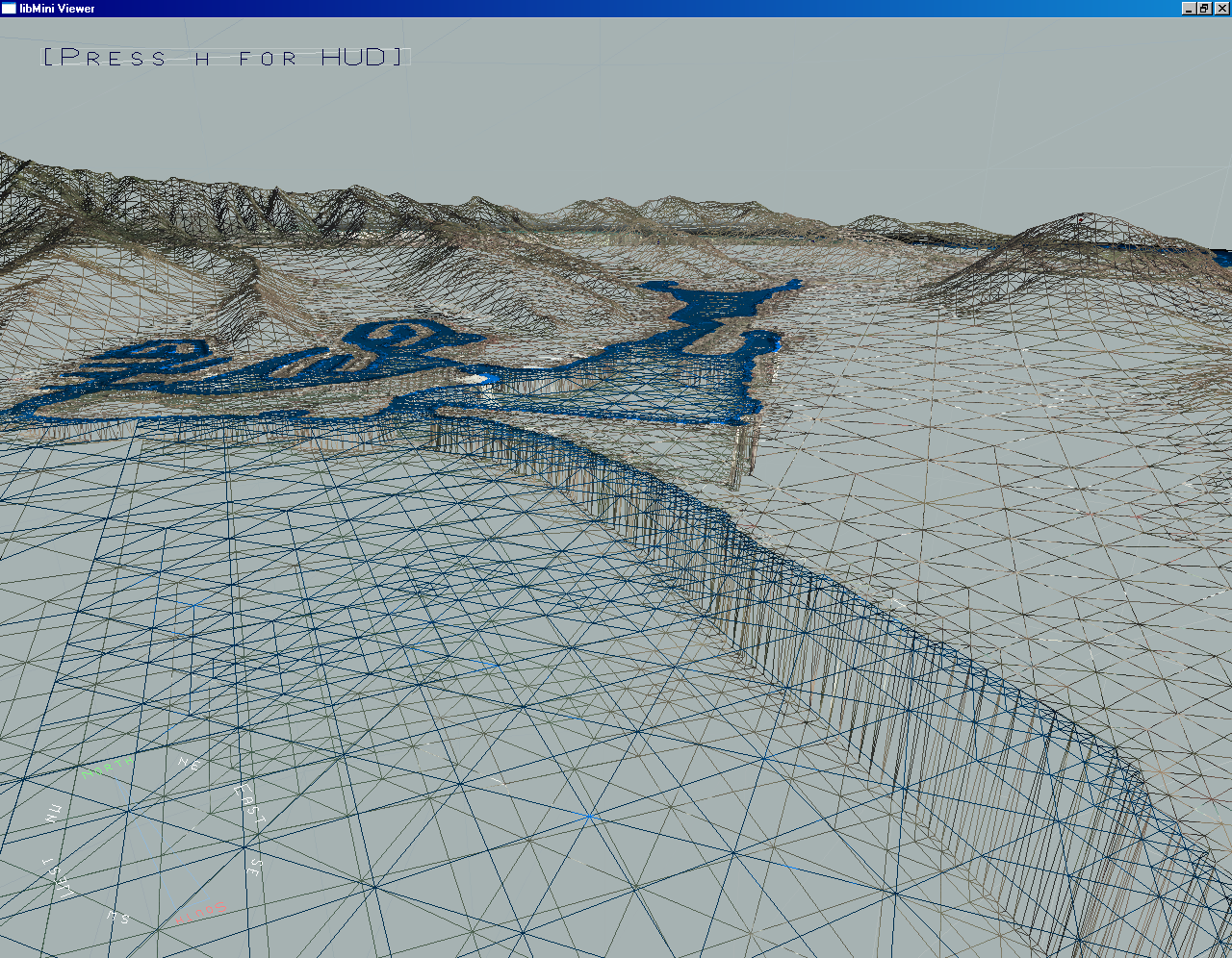
 Hawaii
Kai in wire frame mode to show the contour of the extracted
shore line
Hawaii
Kai in wire frame mode to show the contour of the extracted
shore line
 Hawaii Kai with color-mapped bathymetry using the libMini
pixel shader plugin
Hawaii Kai with color-mapped bathymetry using the libMini
pixel shader plugin
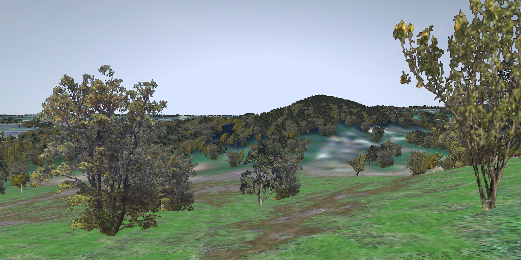
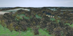
Fränkische
Demo:
The
Fränkische Demo
contains 72MB of compressed GLCF
data. It visualizes the distribution of vegetation near my home town in
the "Fränkische Schweiz" and shows trees and bushes galore. So
please don't bother trying if you do not have a fast machine and a
hi-end GeForce FX!
 The
Hetzlas in the Fränkische Schweiz near Nuremberg, Germany
The
Hetzlas in the Fränkische Schweiz near Nuremberg, Germany
The
included tree textures are from vterrain.org
and the ground textures are from Paul
Bourke, thanks!
The
two following images show the huge impact of adding vegetation to a
scene that is textured with ortho-photos. The seeding of the trees is
determined by the NDVI, the Normalized Difference Vegetation Index.
 The
Hetzlas is much prettier with vegetation
The
Hetzlas is much prettier with vegetation
FaceOfMars
Demo:
This
demo merely is a proof of concept to show the usage of the Mini Library
within the Irrlicht
rendering engine (Linux demo
only, the original Windows version is available at zenprogramming).
 The
"Face of Mars"
The
"Face of Mars"